Explore Jansenville

Explore Jansenville
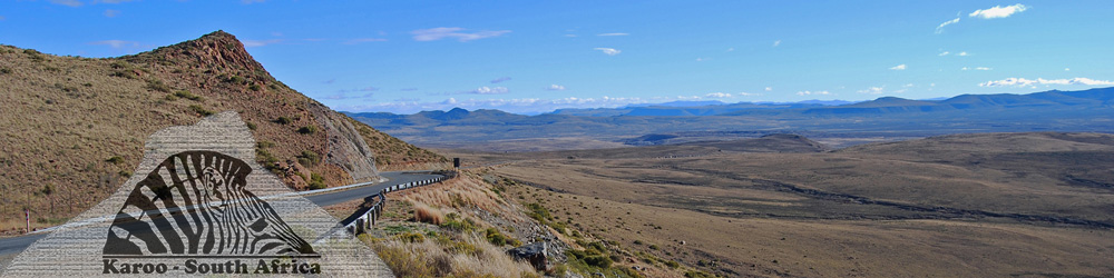
Jansenville lies at the southern entrance to the Camdeboo Plains and is a great base to explore the surrounding countryside of rolling mountains to the south and the wide open plains to the north. The nearby railway hamlet of Klipplaat clings onto its past as one of the most important railway junctions in the Eastern Cape.

The trains these days or somewhat less numerous than in the heyday of rail in South Africa in the century between the 1880s and 1980s. The road from Jansenville to Klipplaat has recently been surfaced and travels through dense copses of Euphorbia coerulescens or Noors. Some ten kilometres before Klipplaat the Noors largely disappears and the landscape becomes more typical of the Karoo with endless open vistas of low bush stretching to the horizon. Klipplaat owes its existence to the enormous value of the wool industry and the need for an effective and reliable means to transport the bales of wool to the coast for export.

In 1856, 6.3-million kilograms or 40 000 bales of wool were produced by the Cape Colony. Of this 5.5-million kilograms was exported through the port at Port Elizabeth. By 1864 the export of wool necessitated the use of 2500 wagons with 9000 drivers and 40,000 oxen to get the wool to the coast. Adverse road conditions and poor grazing for the oxen due to repeated periods of drought resulted in the Midlands railway line as a means to improve the dire transport system.
The railway was started in Port Elizabeth in 1872 reaching Klipplaat in 1879 and beyond to Graaff-Reinet in the same year, vastly improving the transport efficiency of the wool export from the Cape Midlands via Port Elizabeth. In times past Klipplaat had its own municipality and the growth of agriculture and the railways with a branch line to Willowmore and beyond to Oudtshoorn, built after the 2nd Anglo Boer War, terminating in Klipplaat ensured local prosperity.

Klipplaat had its brief moment of fame with the visit of King George VI and Queen Elizabeth together with their daughters Elizabeth and Margaret during the 1947 Royal Visit to South Africa. The train stopped in Klipplaat to take on coal and water on the royal family’s journey across the Karoo.
In recent times the railways have been usurped by road transport and this has resulted in the virtual collapse of the railway network with a devastating effect on Klipplaat. In the village take the time to stop and admire the quaint century-old Methodist and Anglican churches that provide a glimpse on a time long past. Today the village has a rather forlorn air with a rusty steam engine mounted on a plinth and a rather broken down railway station providing a mere glimpse of a more prosperous past.

For a taste of the Karoo of old little changed in the past decades travel due west from Klipplaat along the gravel road to the tiny hamlet of Miller. Miller was once a railway siding on the branch line from Klipplaat to Willowmore, however the closure of this line in recent years has left this tiny community in limbo with almost no economic activity to support their existence. Beyond Miller the gravel road continues through Swanepoel’s Poort bisecting the Grootrivierberge to the R329 linking Steytlerville and Willowmore.
Turning east along the single surviving surfaced strip road in South Africa leads for a distance of 55-kilometres to Steytlerville. The village is situated in the long valley crowded by the Grootrivierberge, or Big River Mountains, to the north and the great bulk of the Baviaanskloof Mountains to the south. Beyond Steytlerville the R329 passes the Valley of the Flags before reaching a gravel turn to the north through the Noorspoort passing the spectacular Draaikrans, an exposed section of the Cape Fold Mountains showing how seismic activity in ages past twisted and folded the rock strata into almost impossible shapes.


The gravel road leads through the Noorspoort emerging from the narrow defile through the Grootrivierberge, or Big River Mountains, onto the southern fringes of the Camdeboo Plain. The road reaches Mount Stewart at the junction linking Klipplaat with Uitenhage. Mount Stewart was established as a railway station on the line linking Klipplaat and Port Elizabeth. With the demise of the local railway services Mount Stewart has slipped into almost complete obscurity. The only building of substance surviving in the hamlet is the chapel dating back to 1904. The chapel stands in glorious isolation on a rise above the hamlet and its simple lines and ageless simplicity in the midst of the open plain is a quintessential element of this part of the Great Karoo. Beyond Mount Stewart the gravel road continues towards Jansenville.

From Jansenville head north along the R75 towards Graaff-Reinet. For a slightly longer excursion take the gravel R337 road turnoff ten kilometres north of Jansenville towards Pearston. Seldom travelled the road to Pearston will reveal the enormity of the wide open plains and the peace and quiet of the southern Camdeboo.

Stopping along the road will often reward the traveller with a sighting of the Blue Crane, South Africa’s national bird, out in the vastness of the open plain.
Springbok are often sighted together with the ever-present herds of merino and dorper sheep. After 58-kilometres the gravel road terminates on the R63 linking Graaff-Reinet and Pearston.
Towards the east the R63 continues beyond Pearston across the Bruintjieshoogte towards Somerset East, whilst north of Pearston the gravel R337 ascends the spectacular Buffelshoek Mountain Pass following a very scenic mountain route towards distant Cradock in the valley of the Great Fish River.

Turning towards Graaff-Reinet at the junction of the R337 and the R63, the road heads along the northern edge of the Camdeboo Plain passing Cranmere Farm, made famous by the book written by Eve Palmer, "The Plains of Camdeboo".
To the north the high ramparts of the 1391-metre high Bouwershoek Mountain, the 1378 Aasvoelberg, or Vulture Mountain and the jagged edge of the 1530-metre high Tandjiesberg or Teeth Mountain, frame the northern horizon rising above the flat plains at an average elevation of 730-metres above sea-level. The R63 terminates at the junction with the R75 linking Jansenville with Graaff-Reinet. Turning towards Graaff-Reinet the R75 leads for 25-kilometres into the historic town of Graaff-Reinet surrounded by mountains and the Camdeboo National Park.


From Graaff-Reinet take the N9 highway towards Aberdeen skirting the great rump of Spandau Kop which towers above the Sundays River and Graaff-Reinet. Some 30-kilometres from Aberdeen the road passes an old cast iron bedstead lying in the veld which according to local folklore marks the grave of a woman who took ill and died while her family was trekking by ox-wagon through the Karoo. As they were not from the area her husband simply buried her where she had died and used their marital bed to mark and protect her grave, thereafter proceeding on the journey with the rest of the family. Although the true details will probably never be known the grave site can be easily seen on the left on the N9 highway towards Aberdeen.

The road between Graaff-Reinet reveals spectacular views of the jagged edge of the 1673-metre high Camdeboo Mountains towards the north-west.
Some seven kilometres before Aberdeen the road passes Gordon’s Kop from where the explorer Captain Robert Jacob Gordon drew a panoramic view of the Camdeboo Mountains in 1777 from the crest of a small koppie or hillock. The spot is marked with a small memorial stone.
At Aberdeen the R61 road branches off the N9 highway west towards Beaufort West and Rietbron, whilst the N9 highway strikes our south-west towards Willowmore and beyond to the Klein Karoo. Take the time to explore some of the architectural gems to be found in Aberdeen together with a bite to eat before heading back to Jansenville along the gravel R338 road via Klipplaat.
South of Jansenville the R75 heads towards Wolwefontein passing the gravel junction to the tiny hamlet of Waterford to the east. At Wolwefontein the R329 road branches west towards Steytlerville and beyond to Willowmore. The R75 continues south-east, exiting the Karoo towards Uitenhage and Port Elizabeth. To the east of the R75 road the Addo Elephant National Park stretches from Darlington Dam near Waterford to beyond Port Elizabeth and Alexandria on the shores of Algoa Bay.