Prince Albert
Explore
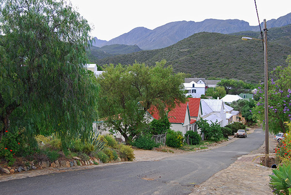
Prince Albert is four hours by car from both Cape Town and Port Elizabeth for those taking the lesser travelled inland route between the two cities. The village is also well situated as a stop-over on the road between Cape Town and Gauteng, a short distance off the main N1 highway. The village is also an excellent base for exploring the wide open spaces of the Great Karoo and the spectacular Swartberg Mountains and mountain passes that link the Great Karoo with the Klein Karoo and the Garden Route of the Southern Cape to the south.
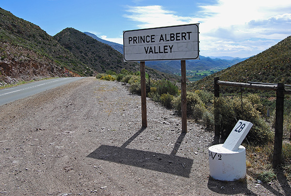
Probably one of the finest scenic routes in South Africa links Prince Albert via the Prince Albert Valley to the tiny village of Klaarstroom on the N12 highway linking Beaufort West and De Rust in the Klein Karoo through the magnificent Meiringspoort to Oudtshoorn.
The return route to Prince Albert from Oudtshoorn via the Swartberg Mountain Pass completes the journey.
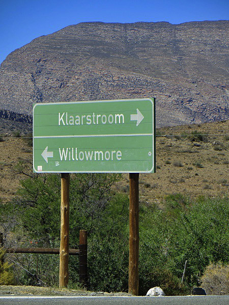
From Prince Albert head south along the R407 towards the high ramparts of the Swartberg Mountains, passing a gravel road turning towards the Swartberg Mountain Pass. The road enters a long valley surrounded by the towering Swartberg Mountains to the south and the Ou Kloofberge to the north. The Prince Albert Valley has been intensely cultivated and the fields of fruit trees and vineyards contrast vividly with the high mountains crowding above. The Valley terminates at the summit of the modestly proportioned Kredouw Mountain Pass and descends into the arid open lands of the Great Karoo towards the east. The R407 joins the N12 highway for a few kilometres south-east towards the tiny village of Klaarstroom situated just off the highway. Opposite the turn into Klaarstroom the R407 branches off the N12 highway towards the east skirting the northern slopes of the Swartberg Mountains towards Willowmore in the Eastern Cape.
Klaarstroom remains one of the very few authentic Karoo villages with the ambience of the 1940s, although little has changed since the days of Queen Victoria. The village was first settled in 1777 with the trekboere, or nomadic farmers, first attracted to the area by the clear streams flowing down from the slopes of the Swartberg Mountains to the south – hence the name which can be translated as Clear Stream. This clean, clear water was first used to wash the dust and dirt off the wool being transported from the Great Karoo through Meiringspoort to the port at Mossel Bay.
A sprinkling of Victorian era buildings were built including the police station in the middle of the village, which was built in 1880 and is acknowledged as one of the most beautiful police station buildings in the country. Behind the police station there were once stables and the police patrolled on horseback in the district until the 1950s.
Some of the buildings in the village date back more than 200 years and the Church of the Good Shepherd’s graveyard contains the remains of a corporal Boyd and Trooper Hirschford, causalities of the Anglo Boer War. Vines were planted and such was the quality of the grapes that the area was compared with Constantia in Cape Town. The rugged farmers of the district however favoured something stronger and turned their talents to making moonshine, more commonly referred to as witblits, loosely translated as white lightning.
Not far from the village, on the farm Vrolikheid, there remains a licensed witblits still, which has been declared a Western Cape Provincial Heritage site.
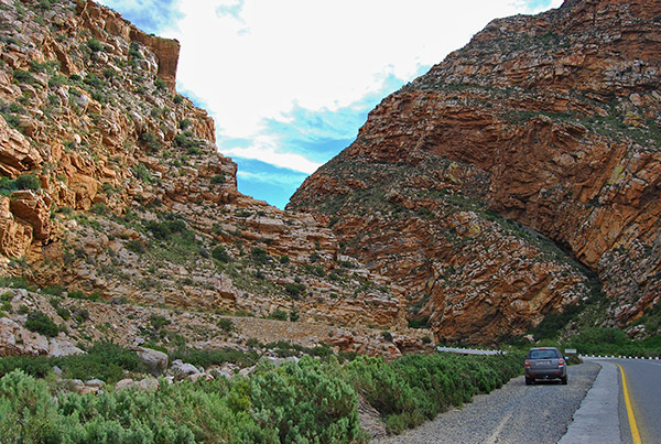
Beyond Klaarstroom the N12 highway sweeps across the first low level drift across the Groot River, or Big River, marking the entrance to the spectacular Meiringspoort Mountain Pass which tracks a narrow defile through the Swartberg Mountains, following the course of the river. Before the construction of Meiringspoort there were no roads linking the Great Karoo and the Klein Karoo.
In 1854 the renowned road engineers Andrew Geddes Bain and his son Thomas Bain together with the irrepressible Sir John Molteno, Member of Parliament for Beaufort West, surveyed the great “kloof” or defile through the Swartberg Mountains, through which Meiringspoort would be constructed.
The road was ultimately surveyed by a number of eminent road engineers including Andrew Geddes Bain and Thomas Bain and the 16-kilometre Pass was constructed in 223 work days, crossing the Groot River 21-times at a cost of £5,018, just £18 above the allocated budget of £5,000. The engineers had initially requested £50,000 in order to construct a properly engineered road, however this was considered unaffordable at the time. Unfortunately the sub-standard road was highly susceptible to flooding as it was constructed in very close proximity to the river bed of the Groot River.
In 1859, 1861 and 1875 the road was closed for long periods due to flooding and a massive flood in 1885 washed almost every vestige of the road away. Over the years the road was rebuilt and improved after repeated flooding, however it was only after a major flood in 1996 that the reconstruction of Meiringspoort was begun.
This resulted in a spectacular road that sweeps through the narrow mountain "poort" with many opportunities to stop and admire the awe-inspiring scenery and the sheer twisted ramparts of rock that tower above the road. The rebuilt road through Meiringspoort was opened in 2000.
Approximately halfway through the "poort" there is an information centre. From this facility a narrow footpath leads around a sheer fold in the mountain to a deep rock pool and cascade of water fed by a mountain stream that sweeps over a lip of rock that frames the blue sky above.
Beyond Meiringspoort the N12 highway reaches the small Klein Karoo town of De Rust and the junction with the tarred R341 road that leads east through the Kamanassie Valley towards Uniondale and Willowmore.
Beyond De Rust the N12 highway traverses the southern slopes of the Swartberg Mountains towards Oudtshoorn, the principle town of the Klein Karoo, a further 35-kilometres distant.
Just beyond De Rust towards Oudtshoorn a gravel road branches north-west towards Spitzkop, hugging the southern slopes of the Swartberg Mountains and passing to the south of the Koos Raubenheimer Dam. The views to the north are framed by the bulk of the Swartberg Mountains and the vista across the dam with the mountains beyond is particularly beautiful.
After a distance of 33-kilometres the gravel road joins the R328 linking Oudtshoorn to the south with the Cango Caves and the Swartberg Pass to Prince Albert beyond. Turning towards Prince Albert the R328 passes the junction leading to the world famous Cango Caves.
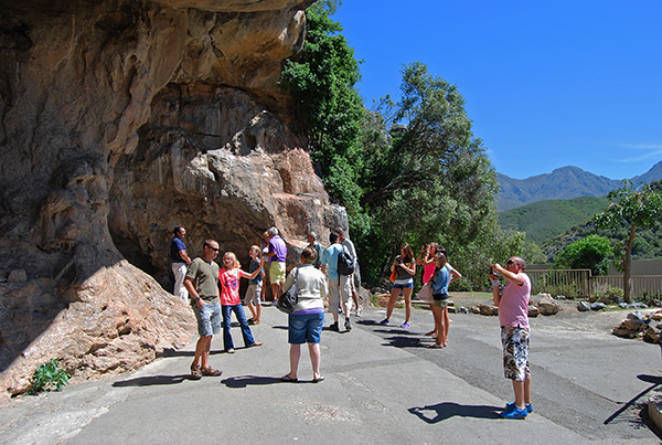
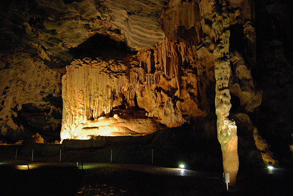
The Cango Caves attract thousands of visitors every year to experience one of the most spectacular limestone cave formations in the world. Two tour options are available. The more sedate Heritage Tour includes the easy to access sections of the caves and includes the spectacular Van Zyl's Hall dominated by the giant organ pipes, a magnificent dripstone flowstone combination.
Cleopatra’s Needle, a slender stalagmite rises almost ten metres from the floor to the ceiling of the cave. Cleopatra’s Needle is thought to be more than 150 000-years old. The Heritage Tour includes other magnificent chambers including the Rainbow Chamber, Bridal Chamber, Fairyland Chamber and the Drum Room.
For the fitter and more adrenalin seeking visitor, the Adventure Trail begins at the termination of the Heritage Trail. This section of the tour takes visitors into the Tunnel of Love, The Ice Chamber, the Ice Coffin, the Devil’s Workshop, the Devil’s Chimney, the Devil’s Post Box and Lumbago Alley, providing visitors with the opportunity to squeeze through small spaces in the labyrinth of the Caves and to experience something of what cave exploration is all about.
During both tours the guides will switch off the lights and the true experience of being in the total blackness of the caves makes one thankful for the light when it is switched back on.
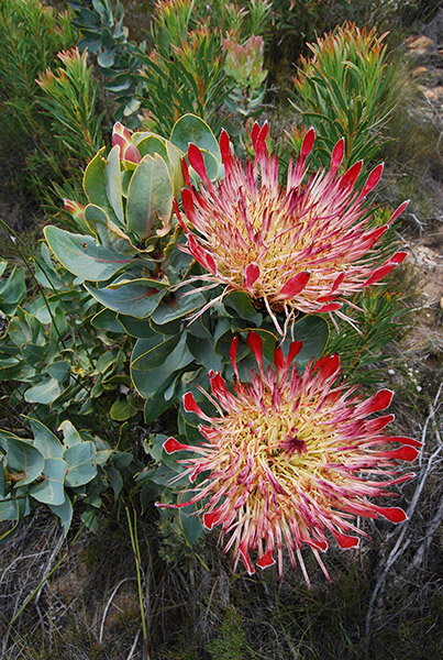
Beyond the Cango Caves junction the R328 begins to ascend the lower slopes of the Swartberg Mountain Range passing the junction west towards Matjiesrivier, or Little Friends River, and beyond to Calitzdorp. From this point the road becomes gravel and begins the ascent of the Swartberg Mountain Pass. The southern slopes of the Swartberg Mountains are particularly beautiful during the spring months with an abundance of flowering fynbos and proteas.
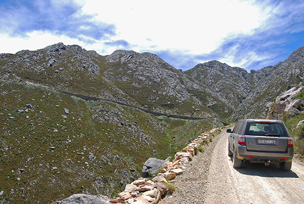
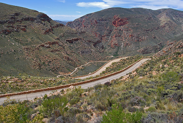
The road ascends steeply across the face of the mountain with Thomas Bain’s signature dressed sandstone walls in areas where the steep mountain slope necessitated extra support for the road. The road passes a number of switchbacks and U turns as it ascends, with the most noticeable named “Skelmdraai” loosely translated as Crooks Corner – perhaps named after one of the many convicts drafted into the construction of the pass.
The views to the south are spectacular with sweeping vistas of fynbos clad mountains and valleys stretching away seemingly to infinity. At intervals as one ascends there are lay-byes where you can alight from your car and savour the beautiful views and breathe deeply on the fynbos scented fresh air of the mountains.
The road ascends to the summit of the pass at 1853-metres above sea level rounding a broad gap in the mountains known as "Die Top" or the Top.
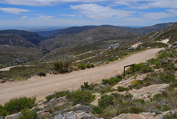
From here a battered old road sign indicates that the distance to Prince Albert is nineteen-kilometres, however this information is dwarfed by the splendour of the vista towards the north with the rolling mountains receding into the distant arid plains of the Koup.
On a clear day the Nuweveld Mountains towering above distant Beaufort West are visible on the far northern horizon.
The road begins the descent of the northern slopes of the Swartberg Mountains through meadows of flowering fynbos resplendent with the blooms of proteas and watsonias littering the landscape in spring.
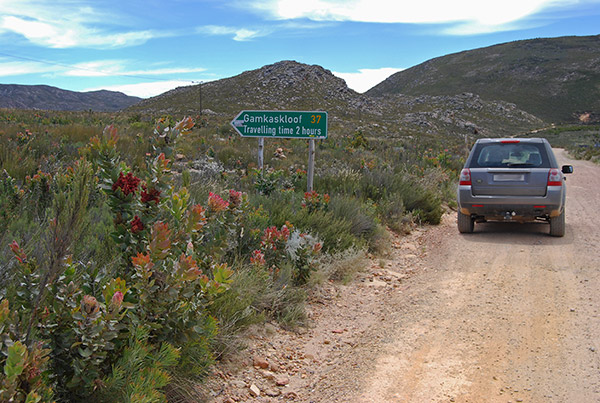
Pull over and take a stroll through this beautiful landscape to admire the prolific fynbos and the spectacular variety of flowering plants dwarfed by the immensity of the surrounding mountains and on a clear day, the vast indigo dome of the African sky. The road reaches the turnoff to Gamkaskloof otherwise known as "Die Hel" or The Hell, a cut-off valley reached by a lonely, winding and precipitous road that ends at the end of the valley on the banks of the Gamka River.
From the Gamkaskloof junction the road towards Prince Albert plunges precipitously into a rugged valley through a series of switchback turns each shored-up by the dressed sandstone walls constructed by Thomas Bain more than 125-years ago. The views down into the valley with the road finding its way down this jumbled mountain side is both beautiful and a marvel of nineteenth century construction. The view from below reveals the extent of the stonework required to have constructed the road from the narrow valley below up onto the high slopes of the mountain. There are a number of places to stop on the way down and the views and the wild serenity of this beautiful mountain pass are a sensory experience of absolute delight. The mountain pass in its entirety is largely unchanged since it was constructed during the 1880s and is fittingly a National Monument and clear evidence of the pioneering spirit of these early road-builders in South Africa. The road traverses a narrow rocky gorge sharing company with a clear mountain stream before emerging from the jumble of mountains rather suddenly into the relative flatness of the Prince Albert Valley and beyond to Prince Albert.
Another shorter drive from the village traverses the northern slopes of the Swartberg Mountains due west towards the Gamkapoort Dam.
Before the construction of the dam this road crossed the Gamka River and connected with Seweweekspoort and Ladismith in the Klein Karoo via Bosluiskloof, or Tick Kloof. This road also provided a link to Laingsburg via the Vleiland Valley and Rooinek Pass.
In order to control the erratic and somewhat violent flooding of the Gamka River with its huge catchment across the Western Koup, the dam was built in 1969. The area is now part of the Gamkapoort Nature Reserve and access to the dam is subject to park entry fees which can be paid at the Prince Albert Tourism Office in the village.
The dam is approximately 40-kilometres from the village and the views across the dam towards the crowding mountains are best experienced in the morning with the sunlight from behind.
Prince Albert is also a great base from which to explore the wide open spaces of the Koup, the vast open landscape between the Swartberg Mountains to the south and the Nuweveld Mountains in the north. From Prince Albert head north along the R407 turning onto the gravel road towards Kruidfontein Station and beyond to Leeu Gamka on the N1 highway. At Leeu Gamka turn onto the R353 towards Fraserburg.
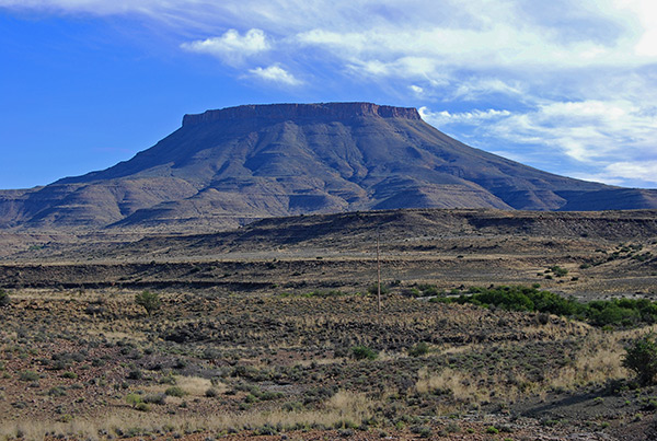
As one travels along the R353 the great bulk of the Nuweveldberge with their symmetrical flat-topped mountain tops rise up out of the undulating plains of the Koup dominated by the Karoo’s own Table Mountain, standing 1913-metres high at the foot of the Teekloof Mountain Pass which leads up the Nuweveld Mountains to the high escarpment and the village of Fraserburg. Approximately 60-kilometres from the junction at Leeu Gamka the road reaches the gravel road junction towards Merweville to the west and Beaufort West to the east. Turning towards Merweville the gravel roads undulates through typical Koup countryside passing isolated farmsteads with occasional distant views of the Nuweveld Mountains to the north and the edge of the escarpment towards Sutherland to the west. The road winds along the banks of the Dwyka River before entering the atmospheric village of Merweville.
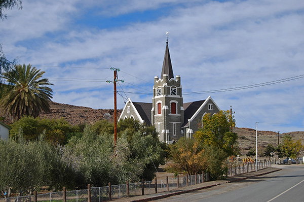
Dominated by its imposing Dutch Reformed Church, Merweville slumbers in the midst of the undulating hills of the western Koup and is a great place to stretch the legs and enjoy a leisurely lunch.
The return trip to Prince Albert leads for 43-kilometres to Prince Albert Road on the N1 highway and onto the 44-kilometre R407 road back to Prince Albert.
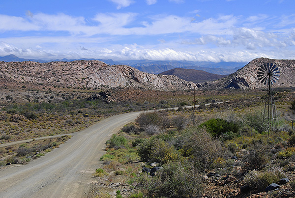
To the uninitiated the landscape may seem a bit harsh and unrelenting, however, if one takes the time to stop and switch off your car’s engine and to savour the long views, the absolute silence and the surreal landscape you will notice the movement of the black-headed dorper and merino sheep across the veld, possibly the croaking of a korhaan, the sound of the breeze and the crackle of the parched undergrowth underfoot and the sense of complete solitude and silence.
If one is travelling east towards Graaff-Reinet, rather than routing via the N1 highway take the little known gravel road directly east along Pastorie Street from the centre of Prince Albert. The road strikes out due east across the southern Koup flanked by the Oukloof Mountains to the south passing through a narrow defile in the Tierberg before terminating on the N12 highway linking Beaufort West and De Rust. Seven kilometres north of this junction towards Beaufort West a gravel road branches off east for 63-kilometres to the isolated village of Rietbron in the midst of the vast "vlaktes" or flats.
Enjoy a light lunch at the local coffee shop before heading out further east towards Aberdeen and distant Graaff-Reinet. This route will ensure that you encounter almost no traffic and will give you the opportunity to experience the wide open plains of the Great Karoo in absolute peace and solitude.


