
Willowmore

Willowmore
Willowmore is best known as the western gateway to the spectacular Baviaanskloof Wilderness area, stretching for more than two hundred kilometres south-east towards distant Hankey and beyond to Port Elizabeth. This is an area of outstanding scenic splendour with the parallel Baviaanskloof Mountains to the north and the Kouga Mountains in the south crowding the Baviaanskloof River valley, culminating in a jumble of rugged mountains at its eastern end. The Baviaanskloof is one of the most spectacular wilderness drives in South Africa and to travel its full length requires a high-clearance vehicle or preferably a 4X4 vehicle.

Willowmore is situated in the midst of the Cape Fold Mountains, just beyond the southern end of the vast Camdeboo Plain. The town is overlooked by the 1413-metre high Boesmanspoort Mountain to the north-west and the vista of rolling mountains stretching away to the east and west dominates the landscape.
North of Willowmore the N9 highway picks its way through the Perdepoort, or Horse Ravine, skirts the eastern edge of the Beervlei Dam, before setting our across the vast open spaces of the Camdeboo Plain towards distant Aberdeen and beyond to Graaff-Reinet.

Just south of Beervlei Dam the gravel R306 road branches off the N9 highway towards Rietbron and beyond to Beaufort West. Just north of the town the R329 branches off the N9 highway east towards Steytlerville along South Africa’s last surviving Provincial strip road.
Construction of the cement strip road between Willomwore and Steytlerville was completed in 1954. The road is a single strip with vehicles having to move onto the gravel verge for oncoming traffic. The length of the cement road is 36-kilometres. This road is the shortest route from Willowmore to Port Elizabeth.
Just south of Willowmore the N9 highway reaches the gravel junction south-east to the Baviaanskloof and beyond this point descends the Buyspoort and Ghwarriepoort Mountain Passes before entering the Western Cape and onwards towards Uniondale or Oudtshoorn in the Klein Karoo.
The scenic R407 gravel road west from Willowmore skirts the northern slopes of the Swartberg, or Black Mountains, towards the tiny village of Klaarstroom and beyond to Prince Albert.
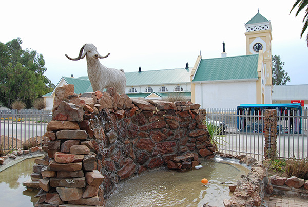
Farming in the Willowmore district transitions from the drier northern areas to the higher rainfall areas of the more mountainous south. Most farmers are small-stock farmers producing merino and dorper sheep, cattle and ostriches.
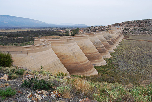
The construction of the Beervlei Dam north of Willowmore was completed in 1957 and was intended to control the devastating floods that occasionally occurred in the catchment of the Groot River across the mostly arid plains of the Camdeboo and the eastern Koup.
The dam is however somewhat obsolete as it is mostly silted up and empty. The run-off from flooding has diminished because of improved farming practices and the construction of numerous anti-soil erosion structures in the catchment area.

Willowmore offers a variety of interesting historical buildings and other attractions, many of which date back to the 19th century. The iconic town hall in Knysna Street, with its wedding cake clock tower was built around 1896 and is the centre point of the Willowmore community.
The building is used for film shows, amateur theatrical productions, soirées, wedding receptions and funerals. Other notable buildings include St Matthew's Anglican Church, completed in 1881.

The Old Jail was constructed from local stone and the walls are half a metre thick, and was completed in 1880. The outside corners, windows and doors are decorated with plaster quoins. The Old Gaol, as it was then called, consisted of a hospital cell, hard labour cells, awaiting trial cells, a female cell and a kitchen cell.
It was decommissioned as a prison around 1950, was abandoned for more than a decade, and then converted into a luxury guesthouse by its current owners.

Before Willowmore was connected to the national electricity grid in 1984 the town was supplied with electricity by its own power station known as the Blackstones. The six Lister Blackstone diesel generators were shipped from England and then came up by rail to Willowmore. The largest of these engines is still in working order.
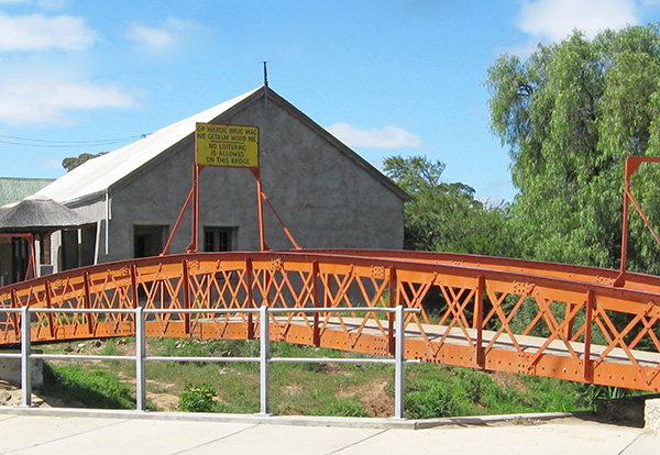
The iconic Red Bridge in Knysna Street was erected as a pedestrian bridge over the Noodsloot and was used by pedestrians when the stream was in flood. The bridge predates the road bridge and was built when the road forded the stream through a drift.
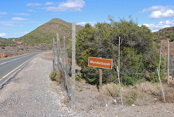
Situated to the north of Willowmore towards Aberdeen along the N9 highway is the ‘Wonderboom’ or Wonder Tree, an aberration of nature. Consisting of two varieties of small trees growing next to each other, the Common guarri Euclea undulta and a Sheperd's Tree Boscia oleolides, the Wonderboom has 3 stems.
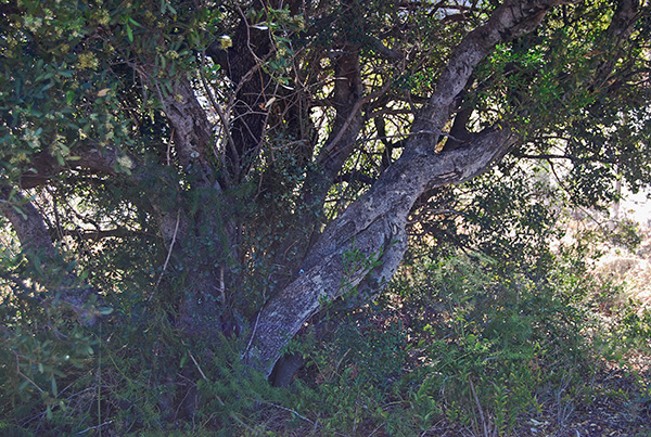
Two of the stems of the Sheperd’s Tree have joined each other, forming an "eye of a needle" and the third stem of the Common guarri has grown through the eye, forming the "thread" through the eye of the needle.
The "Wonderboom" was discovered as early as 1906 when the road was constructed between Willowmore and Aberdeen. It was only when the road was first tarred in 1961 that it received more attention and was acknowledged as a wonder of nature.
Just to the north of the town ‘Aasvoëlberg, or Vulture Mountain, overlooks Willowmore. A road has been constructed to the top of the mountain providing access for high clearance vehicles.
The summit of the mountain is one of the few accessible places in the Karoo where you can find both proteas and other fynbos species, as well as Karoo succulent plants.
The sandstone rock formations on the mountain are spectacular and the panoramic views from the summit stretch far and wide, encompassing the impressive Cape Fold mountain ranges stretching away to the east and west, a fitting place to take in the beauty and splendour of this corner of the Karoo.

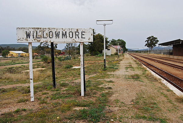
The Baker’s Dam in the vicinity of Aasvoëlberg was built by the South African Railways in 1906 to supply the steam locomotives in Willowmore with water on the now defunct railway line between Klipplaat and Oudtshoorn.
With the advent of diesel locomotives, the Municipality took over the dam to serve as the town's primary source of water at the time. Today the dam is a favourite haunt of bird watchers.

The old Boer graveyard has interesting graves dating back to the 2nd Anglo Boer War. Many of the graves stones have been recently restored and the old fashioned marble headstones are a poignant reminder of the deadly conflict that took place in the district more than a century ago.
From the graveyard it is an easy walk to the small gunpowder chamber which was used to store gunpowder and ammunition during the conflict. Remnants of the old British forts built during the 2nd Anglo Boer War can be seen outside the town on the Pierre Ferreira Walking Trail.